San Francisco catches visitors out in ways a map won't show. Two blocks on screen can be a 15-minute climb, and fog rolls in from the Pacific by early afternoon, even in July.
Transit is patchy too: some neighborhoods are an easy Muni ride, others mean a rideshare. Sort out these basics before you arrive and the trip gets a lot easier.
Key facts at a glance
- A single Muni bus or light rail ride costs $3.00 in cash for adults, or $2.85 with Clipper or MuniMobile. A Muni Day Pass costs $5.70 and covers unlimited rides on buses, light rail, and historic streetcars for one day. Source: SFMTA
- Cable car rides cost $9 per boarding as a standalone fare. The Clipper card does not discount cable cars below this rate, but a 1-Day Visitor Passport ($15) covers cable car rides. The regular Muni Day Pass does not.
- BART connects San Francisco International Airport (SFO) to downtown's Civic Center and Powell Street stations in roughly 30 minutes. A one-way fare from SFO to downtown is $11.80 on Clipper. Source: BART
- The Clipper card is a reloadable transit card that works on Muni, BART, Caltrain, and AC Transit. You can pick one up at SFO's BART station, Walgreens locations citywide, or at sfmta.com.
- San Francisco's average high temperature in July is 66°F. The average low in January is 47°F. The foggiest months are June through August, when afternoon temperatures in the Sunset and Richmond districts can drop to 55°F while the Mission District stays 10 to 15 degrees warmer.
- Rideshare pickup at SFO requires going to the designated app-based ride pickup area on the Departures level, Level 5 of the Domestic Garage.
- San Francisco's 311 service (call or text 311) handles non-emergency city questions including transit disruptions, street closures, and neighborhood service issues. Source: SF311
How Muni and BART actually connect the city
Muni covers most of San Francisco through a network of buses, the Metro light rail lines (J, K, L, M, N, T), and the historic F-Market streetcar that runs along Market Street and the Embarcadero. For visitors staying downtown or in neighborhoods like the Castro, Mission, or Inner Sunset, Muni handles most trips without needing a car.
BART is a separate regional rail system that runs underground through downtown San Francisco at Embarcadero, Montgomery, Powell, Civic Center, and 16th Street Mission stations.
BART is the fastest way to reach SFO, Oakland, and Berkeley, but its eight San Francisco stations, which also include 24th Street Mission, Glen Park and Balboa Park, leave most neighborhoods unserved.
The Clipper card works across both systems and saves you from buying paper tickets at machines. Load it at any BART station, at Walgreens, or online at clippercard.com. If you plan to use transit more than twice a day, a Muni Day Pass at $5.70 pays for itself quickly, since each individual Muni ride costs $2.85 with Clipper or $3.00 in cash.
The SFMTA MuniMobile app lets you buy Muni passes on your phone without a physical card. Google Maps and Apple Maps both give accurate Muni and BART directions, including real-time departure data.
Where transit works and where it breaks down
The city is only 7 miles by 7 miles, so it looks walkable on a map. The hills change that fast. The climb from Fisherman's Wharf to Coit Tower is a 300-foot elevation gain over about 0.4 miles.
The walk from Union Square to Alamo Square covers 1.5 miles but includes a steep climb up Hayes Street that most visitors do not anticipate.
The western neighborhoods, including the Outer Sunset, Outer Richmond, and the area around Ocean Beach, get Muni buses but no light rail. Bus frequency on these routes drops to every 15 to 20 minutes in the evenings, so plan around schedules rather than assuming a bus will appear.
The Tenderloin, which is between Union Square and Civic Center, is a neighborhood many visitors cut through on foot without realizing it. It has a high concentration of street-level drug activity and is worth routing around, especially at night.
For trips to Golden Gate Park, the N-Judah Metro line drops you at the eastern end near the de Young Museum. The 5-Fulton bus covers the northern edge (SFMTA has suspended the 21-Hayes). Neither gets you to the western end near the Dutch Windmill without a transfer or a long walk, so factor that in if you are planning a full park day.
San Francisco transit options compared
| Option | Best for | Cost | Coverage gaps |
|---|---|---|---|
| Muni bus and light rail | Most neighborhood trips within SF | $3.00 per ride or $5.70 day pass | Slow in traffic; limited late-night frequency |
| BART | SFO airport, East Bay, downtown SF | $11.80 SFO to downtown on Clipper | 8 SF stations; most neighborhoods not served |
| Cable car | Tourist routes on Powell and Hyde/Mason | $9 per ride (covered by Visitor Passport) | Three lines only; not practical for commuting |
| Rideshare (Lyft/Uber) | Late night, hills, western neighborhoods | Surge pricing common; $15-35 typical SF trip | Traffic delays; SFO pickup requires Level 5 garage |
| Clipper card | Combining Muni and BART on one card | No fee; load online or at stations | Cable car discount not available below $9 |
Insider tips for San Francisco's fog and microclimates
San Francisco's weather varies by neighborhood more than by season, and this catches visitors who pack for a single climate. The fog pattern is predictable: marine layer burns off in the Mission, SoMa, and downtown by mid-morning, but the Sunset District, Richmond, and areas near the ocean often stay overcast and cool until mid-afternoon or all day.
In June, July, and August, afternoon temperatures at Baker Beach or Ocean Beach regularly hover at 55°F to 58°F with a 15 to 20 mph wind off the Pacific. Pack a windproof layer regardless of what the calendar says. The Mission District, sheltered by hills to the west, runs 10 to 15 degrees warmer on the same afternoon.
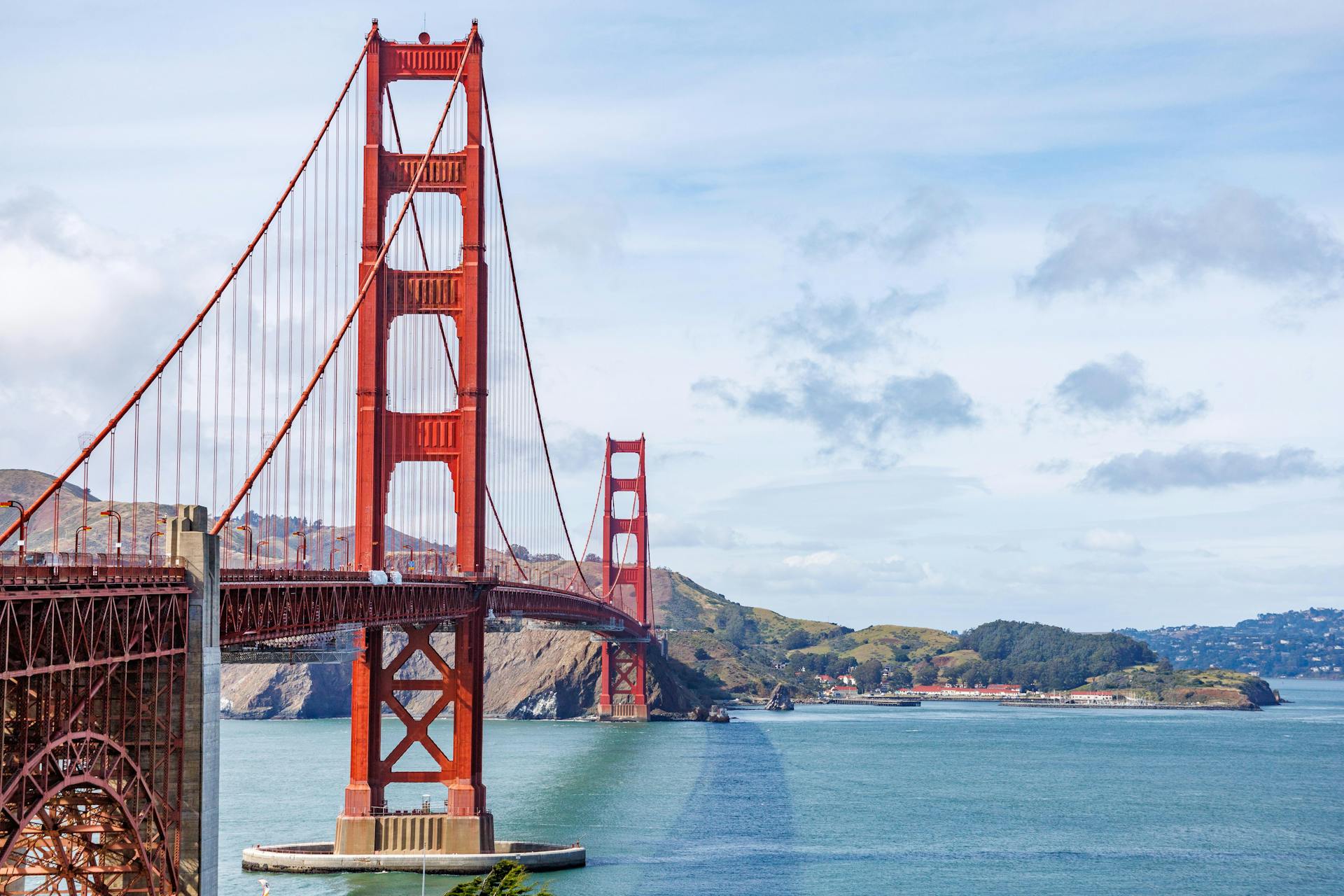
The Golden Gate Bridge is frequently fogged in during morning hours. If you want clear views, visit between 11 a.m. and 2 p.m. on most days, or check the National Weather Service San Francisco Bay forecast the morning of your visit.
The bridge's south vista point parking lot fills by 9 a.m. on weekends; take the 28-19th Avenue or 29-Sunset bus instead.
How to save money in San Francisco on food, transit, and attractions
The San Francisco CityPASS bundles admission to the California Academy of Sciences, the Aquarium of the Bay, the Exploratorium, and a Blue and Gold Fleet bay cruise for around $89 for adults, compared to roughly $160 if you paid separately. It also includes three days of Muni access.
For food, the Ferry Building Marketplace at 1 Ferry Building has high-end vendors, but the Tuesday and Thursday farmers markets outside it offer cheaper prepared food from 10 a.m. to 2 p.m. The Mission District along 24th Street has taquerias where a full burrito runs $10 to $13, a fraction of what you pay at tourist-facing restaurants near Fisherman's Wharf.
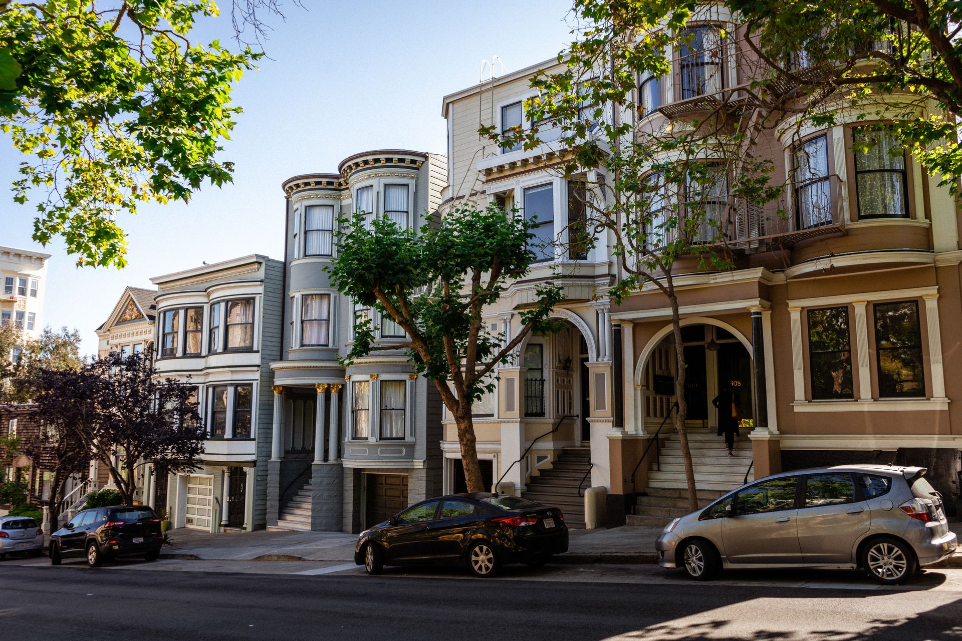
Many of San Francisco's best experiences cost nothing. Dolores Park on a sunny afternoon, the Lands End Trail with views of the Golden Gate, the Painted Ladies at Alamo Square, and the Embarcadero waterfront are all free.
The San Francisco Public Library issues free visitor library cards that include free museum admission through the Museum on Us program on the first full weekend of each month.
Parking in San Francisco is expensive at downtown garages, often reaching premium daily rates. If you rent a car, park it for the duration of your stay and use Muni. Street parking in residential neighborhoods requires a permit on most blocks, and the city issues tickets aggressively.
Tips for visiting San Francisco's neighborhoods without a car
Downtown, Union Square, SoMa, and the Financial District are the most transit-dense areas, with multiple Muni and BART lines converging at Powell Street Station.
The Mission District is one of the most walkable neighborhoods for visitors. The 16th Street Mission BART station drops you at the center of the action, and the flat grid between 16th and 24th Streets covers most of the restaurants, murals, and bars worth visiting. The Clarion Alley murals between Mission and Valencia Streets are a 5-minute walk from the BART station.
North Beach and Chinatown are close together on the map but require either a steep walk from downtown or a bus. The 30-Stockton and 45-Union/Stockton buses connect Union Square to both neighborhoods in about 10 minutes. The Columbus Avenue corridor in North Beach has the city's best Italian cafes and is worth a morning visit before the crowds arrive.
Haight-Ashbury is not well-served by light rail. The 7-Haight/Noriega bus runs along Haight Street, but frequency drops to every 12 to 15 minutes. The N-Judah Metro stops at Carl and Cole Streets, a 10-minute walk from the main Haight Street strip. Budget extra time if you are combining Haight with other neighborhoods in a single day.
Practical tips for first-time visitors
- Get a Clipper card at the SFO BART station before you leave the airport. Load $20 to $30 to cover your first day of transit without hunting for a reload point.
- Download the SFMTA MuniMobile app before your trip. It shows real-time bus arrivals and lets you buy day passes without a physical card.
- Pack a layer in your day bag every day, regardless of the morning temperature. Afternoon fog in western neighborhoods and at the waterfront drops temperatures 10 to 15 degrees within an hour.
- Avoid renting a car unless you are day-tripping to Marin County, Napa, or the Peninsula. Parking costs, traffic, and the city's one-way street grid make driving within San Francisco more trouble than it saves.
- Check the 511 SF Bay real-time transit tracker for Muni delays before heading to a stop. Muni buses run on time roughly 70% of the time, and knowing about a gap in service lets you switch to a rideshare before you are already waiting.
Sustainable travel in San Francisco
San Francisco's transit network makes low-carbon travel practical for most visitors. Muni carries about 502,000 riders on an average weekday, and the system runs on a mix of electric trolley buses, electric light rail, and diesel-hybrid buses.
The city's San Francisco Climate Action Plan targets 80% of all trips made by walking, biking, or transit by 2030. Visitors who use Clipper cards on Muni and BART, walk the flat eastern neighborhoods, and rent a bike through Bay Wheels for Golden Gate Park contribute directly to that goal. Bay Wheels is now called Lyft Bike, and you rent its bikes through the Lyft app.
Official sources for planning your trip
- SFMTA (San Francisco Municipal Transportation Agency): Muni schedules, fares, Clipper card info, and service alerts
- BART: Regional rail schedules, SFO connections, and trip planner
- SF Travel (San Francisco Tourism): Official visitor guide, neighborhood maps, and event listings
- National Weather Service San Francisco Bay: Daily forecasts by neighborhood and marine layer predictions
Things to do in San Francisco, by neighborhood
Where to start in each neighborhood, and what’s on there this weekend.
All 68 San Francisco hotel guides →
Frequently asked questions
What's the cheapest way to get from SFO to downtown San Francisco?+
BART is the cheapest and most reliable option. The fare from SFO to Powell Street or Civic Center is $11.80 on Clipper and the trip takes about 30 minutes. Trains run every 15 to 20 minutes. A rideshare from SFO to downtown typically costs considerably more, and traffic on US-101 can add 20 to 40 minutes during peak hours.
What's the best way to get around San Francisco without a car?+
A Clipper card loaded with a Muni Day Pass covers buses, light rail, and historic streetcars for a flat daily rate; cable cars need a Visitor Passport. For most visitors staying in central neighborhoods, Muni handles the majority of trips. BART covers the downtown corridor and SFO. For late-night trips or western neighborhoods with infrequent bus service, Lyft and Uber fill the gaps. Avoid renting a car for in-city travel.
Why is San Francisco so cold in summer?+
The Pacific Ocean drives a marine layer of fog and cool air into the city each afternoon, particularly from June through August. The effect is strongest in western neighborhoods like the Sunset and Richmond, where afternoon temperatures can hover around 55°F to 58°F while the Mission District stays in the low 70s. Pack a windproof layer in your bag every day, even when the morning looks sunny.
What's the best neighborhood to stay in for first-time visitors?+
Union Square and SoMa put you within walking distance of BART, multiple Muni lines, and major attractions. The Mission District offers better food options and a more local atmosphere, with direct BART access at 16th Street Mission station. North Beach suits visitors who want walkable access to Chinatown, the Embarcadero, and Fisherman's Wharf, though transit connections require a bus rather than rail.
How do I use the Clipper card in San Francisco?+
Pick up a Clipper card at any BART station, including SFO, or at Walgreens locations across the city. Load cash value or a Muni Day Pass at the machine or online at clippercard.com. Tap the card on the yellow reader when boarding Muni buses and light rail, or at BART fare gates. The card automatically deducts the correct fare for each system.
What are the most common mistakes visitors make in San Francisco?+
Underestimating hills is the most common one. Two blocks on a map can mean a 200-foot climb. Visitors also pack for warm weather in summer and get caught in 55°F afternoon fog without a layer. Renting a car for in-city travel adds premium parking costs with no speed benefit over Muni. Finally, many visitors skip the Mission and Outer Sunset entirely and miss the neighborhoods where locals actually eat and spend time.